|
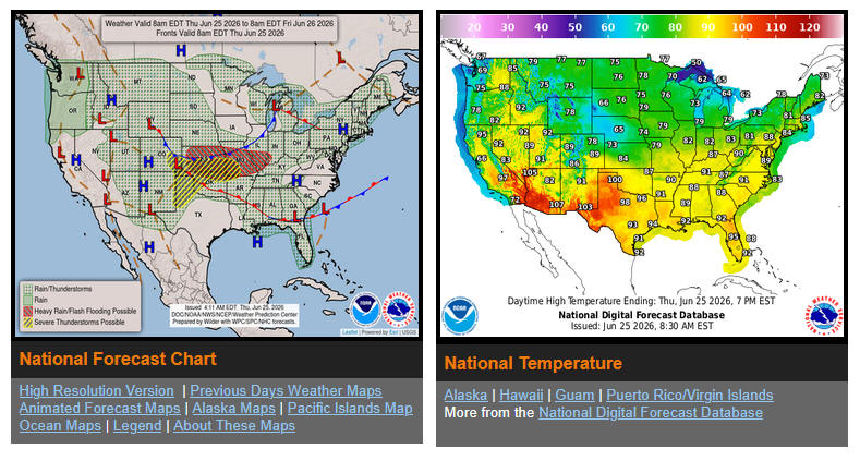
United States
weather map
showing each county of all
the states
weather warning statements
Red Flag wind advisories
Tsunami warnings at
Tsunami.gov
Temperatures
for select cities
weather in
Australia
weather forecast & temperature maps
also fire weather and outlooks
weather.gov
a note on
"weather
confidence"
The climate of changing
Gulf of Mexico to Gulf
of America is catastrophic.
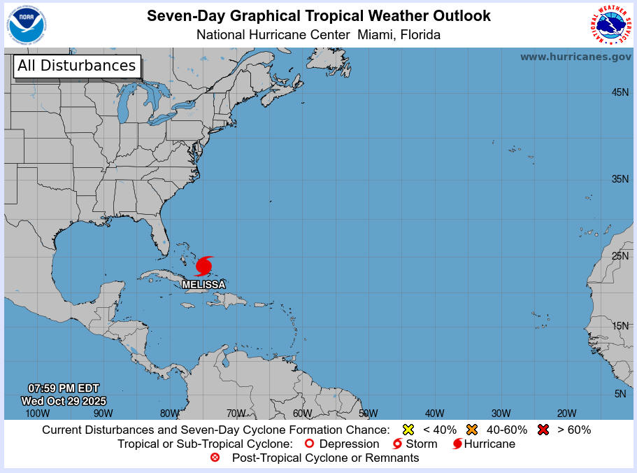
Hurricane
melissa brought warnings such as this
"Marine warnings are in effect for the Gulf of America,
Caribbean/SW Atlantic, SW North Atlantic and Eastern Pacific".
Where is the Gulf of America?
There are 3
Americas is it South America?
I know exactly where is
Caribbean/SW Atlantic, SW North Atlantic and Eastern Pacific but
I haven't a clue where is Gulf of America, which
America???
Maybe
this is describing a gulf in the Central America?? Maybe there is a Gulf of California that is being described.
Why wasn't that named Gulf of America?
The United States is in North America so
it should be called the Gulf of North America.
The United States is not America that is slang calling
it that.
The United States is in one of 3 Americas, North America.
America is bigger than the USA. America contains North,
Central, South.
America is half the world. United States is not.
The United States of America everyone knows is only a part of
North America. There is no other United States. Canada, Mexico, Alaska are all in North
America.
Go back to calling
it the Gulf of Mexico.
active fires
USA & Canada
Earthquakes at
https://earthquake.USGS.gov
Travel
resources
Travel Math
- distances
CalTrans quick maps
shows road conditions real time
Wind farms use electricity
On 1-5-2020 I noticed a wind turbine spinning off the Interstate 10 at
Palm Springs. It may have been using energy to produce wind.
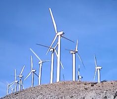
click image to view this film
About
ten minutes later I saw four of it's nearby friends join the wind
producing event. They all made a lot of air move. All of the other 2000+
wind turbines in that area were sitting on their butts doing nothing.
They must have partied too much the night before. The cool desert breeze
itself also was resting. I find out later in the day that these things
can be turned off and still be
running
and blow apart strewing parts everywhere.
Notice there are cars right below the turbines on the hill as seen in
the film above.
here is another LONE WIND RANGER as seen at
the desert drive-in
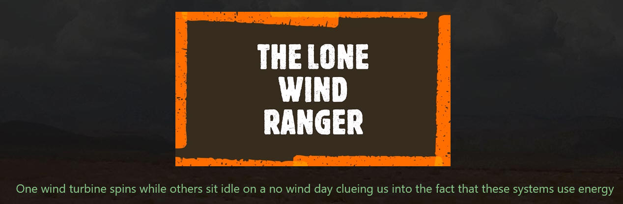
LEARN MORE ABOUT THESE LONE WIND RANGERS
calling these
things farms is so absurd
THEY DONT GROW ANYTHING
The FAKE-A-DEMIC hustle starts with mention of how they needed testing
on real humans to push their pharma product hustle on the masses with an
alleged modified ribosome dinosauraus neucalear acid not alkaline and
the absurdity of believing that we inhale and exhale and spread dis
ease, if that was true no one would be alive.
Influenza came from the Latin term that meant INFLUENCE.
|