|
LINE FIRE CalFire map & warnings as of Saturday 10/12/24 @ 8 am
Evacuation
orders
and
warnings
all lifted.
94% contained.
current camera view
Forest remains closed.
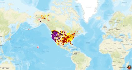
National Interagency Fire Center live satellite map
Size 43,978 acres view 3D map forestry and regional orders
San Bernardino county sheriff x page has evacuation data
previously
On this 3 dimension map they use a traffic signal color scheme
deep red is burn areas, light red is evacuation ORDER, yellow is evacuation WARNING, light green is evacuation order LIFTED
Snow Summit cam looking west had shown big flames 7pm on 9/30/24
they are working Santa Ana River drainage as of status report 9/30/24 at noon
11:31 am Monday looking west across Big Bear lake
6:11 am looking west partial view from Big Bear
5:11 am looking west view from Big Bear cam at
5:27 am looking west
view from snow summit cam 1:25 am looking west
view at 5:08 am looking west
all evacs were lifted last week - evacuation ORDERS and warnings in place now
red dots show more recent fire activity
5:40 am on 9/30/24
BRIDGE FIRE CalFire map & warnings and orders vacated
National Interagency Fire Center live satellite map
Inciweb updates maps resources
San Bernardino, California 92415-0061
NON-EMERGENCY DISPATCH
Desert – (760) 956-5001Valley – (909) 387-8313
archive of prior LINE FIRE data
resources
National Interagency Fire Center
current wildfires and incidents click on maps for details
USA/Mexico/Canda/Alaska/Hawaii
Riverside County active events
San Bernardino County fire incidents